Earthquake alerts from Korea and Japan, in one browser tab.
KR_EQK shows earthquake alerts and reports from the Korea Meteorological Administration and the Japan Meteorological Agency as they are issued.

Easy for anyone — just type eqk.earthquake.kr in your address bar.
Go to the serviceWhen an earthquake strikes Korea
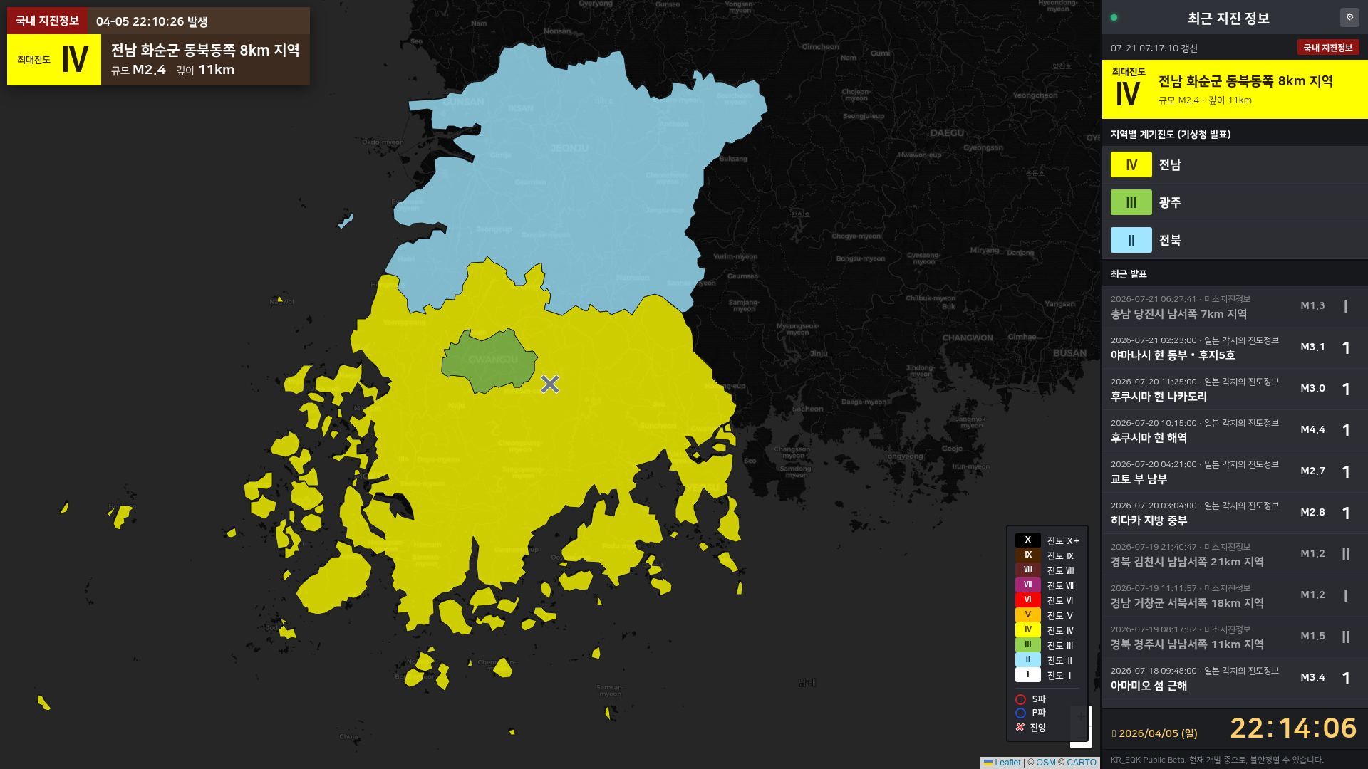
The KMA issues its earthquake alerts within seconds of a quake. The monitor switches views the moment one arrives, drawing the P-wave and S-wave spreading from the epicentre, and fills in measured intensity by province once the detailed report follows.

When an earthquake strikes Japan
25 June 2026, 07:30 — off the coast of Iwate
A real M6.9 event that reached a maximum intensity of 6 Upper on the JMA scale.
-
Emergency Earthquake Warning issued
When the warning arrives, P- and S-waves begin spreading from the epicentre.
If the telegram carries forecast intensities by region, those appear in the panel on the right.

The 19th bulletin. The warning box sits top-left while the P- and S-waves spread from the epicentre; because this is a replay, the clock shows the original time in yellow. -
Seismic Intensity Bulletin issued
Observed intensities are listed in the right-hand panel and shaded onto the affected regions on the map.

Observed intensity badges by subdivision. Magnitude and depth are still being analysed. -
Hypocentre Information issued
Once the hypocentre and magnitude are determined, they are added to the display.

The confirmed hypocentre and magnitude. -
Intensity Report by Region issued
The final report lists observed intensity for every region — shown in the right-hand panel and shaded across the map.

Intensity badges by subdivision, coloured with the NHK intensity palette.
When a tsunami advisory is issued
When a tsunami bulletin is issued, coastlines are drawn in the colour of their grade — Major Tsunami Warning, Tsunami Warning, Tsunami Advisory — with estimated arrival times and wave heights listed per forecast zone.

Design customisation
The Design tab in settings lets you customise how the map is drawn — from intensity marker designs to per-station intensity display, a range of design options is available.

Mobile support
The service works on mobile too — a layout built for small screens that puts information delivery first.


And the rest
- Multilingual support
- The service supports Korean, Japanese and English. (With Japanese selected, Korean place names appear in English, and overseas earthquake reports do not support localised place names.)
- Alert sounds
- Each kind of bulletin plays its own alert sound, so you can tell what was issued at a glance by ear. You can preview them all in settings.
- Simulations
- Replay real past bulletins to see exactly how the screen behaves. Replays stay on your screen only.
- Auto zoom
- When an earthquake strikes, the map adjusts its own zoom to follow the spreading waves and the extent of each bulletin.
- DMDATA link
- For even faster delivery of Japanese earthquake early warnings, you can link your own DMDATA subscription. Your API key is never stored on our servers — it stays in your browser only.
Real-time live stream
The service streams live on YouTube, 24 hours a day.
Watch on YouTubeFree to use, always.
The service is free for personal use, and you are welcome to put it on screen for broadcasts and streams.